ഡിജിറ്റൽ സർവേ കേരളം: 2024 ലെ പുതിയ മാറ്റങ്ങൾ
കേരളം, അതിന്റെ സാങ്കേതിക മുന്നേറ്റങ്ങൾ കൊണ്ട് പ്രസിദ്ധമാണ്. ഇക്കാലത്ത് ഡിജിറ്റൽ രീതികൾ എല്ലാത്തിലും നടപ്പാക്കപ്പെടുന്നുണ്ട്. അതിനൊപ്പം, സർക്കാർ പ്രവർത്തനങ്ങളിൽ കൂടി ഡിജിറ്റൽ മാറ്റങ്ങൾ കൊണ്ടുവരാൻ കേരളം ശ്രമിക്കുന്നു. ഈ സാങ്കേതിക പുരോഗതിയുടെ ഭാഗമാണ് ഡിജിറ്റൽ സർവേ. 2024-ൽ കേരളത്തിൽ നടക്കാൻ പോകുന്ന ഡിജിറ്റൽ സർവേ പ്രോജക്റ്റിന്റെ ഭാഗമായി ജനങ്ങൾക്ക് ലഭിക്കുന്ന പ്രയോജനങ്ങളും വിവിധ ഘട്ടങ്ങളും മനസ്സിലാക്കാം.
ഡിജിറ്റൽ സർവേ: എന്താണ് അതിന്റെ പ്രാധാന്യം?
ഡിജിറ്റൽ സർവേ പ്രോജക്റ്റ്, സംസ്ഥാനത്തെ ഭൂമിയുടെ വിശദാംശങ്ങളും ഭൂമിയുടെ ഉപയോഗവും പുതിയ സാങ്കേതിക വിദ്യയുടെ സഹായത്തോടെ കൂടുതൽ സുതാര്യവും കൃത്യവുമാക്കുക എന്നതാണ് പ്രധാന ലക്ഷ്യം.
- പാരദർശിത്വം: ഭൂമി രേഖകളും ഉടമസ്ഥാവകാശവുമൊക്കെ വിശദമായി സൂക്ഷിക്കുകയും പൊതുജനങ്ങൾക്ക് ലഭ്യമാക്കുകയും ചെയ്യും.
- ഉത്തരവാദിത്വം: ഭൂമി സംബന്ധിച്ച തർക്കങ്ങൾ കുറയ്ക്കാനും ഉടമസ്ഥാവകാശം ഉറപ്പാക്കാനും സഹായിക്കും.
- സാമ്പത്തിക നേട്ടം: സർവേ പ്രക്രിയയിൽ ഉണ്ടാകുന്ന കാലതാമസം കുറയ്ക്കുകയും, ഭൂമി ഇടപാടുകളിൽ കാര്യക്ഷമത ഉറപ്പാക്കുകയും ചെയ്യും.
ഡിജിറ്റൽ സർവേ 2024: പ്രോജക്റ്റിന്റെ ഘട്ടങ്ങൾ
1. പ്രാരംഭ തയ്യാറെടുപ്പ്:
- പദ്ധതിയുടെ രൂപരേഖ: സംസ്ഥാന സർക്കാർ, നിക്ഷിപ്ത സ്ഥാപനങ്ങൾക്കൊപ്പം പദ്ധതിയുടെ രൂപരേഖ തയാറാക്കുന്നു.
- സാങ്കേതിക പരിശീലനം: സർവേയ്ക്കായി ജീവനക്കാരെ സാങ്കേതികപരമായി പരിശീലിപ്പിക്കുന്നു.
- സാധനങ്ങൾ: സർവേ സാധനങ്ങൾ (ഡ്രോൺ, ജിപിഎസ്, ലേസർ സ്കാനർ മുതലായവ) ക്രയവിക്രയം ചെയ്യുന്നു.
2. സർവേ പ്രക്രിയ:
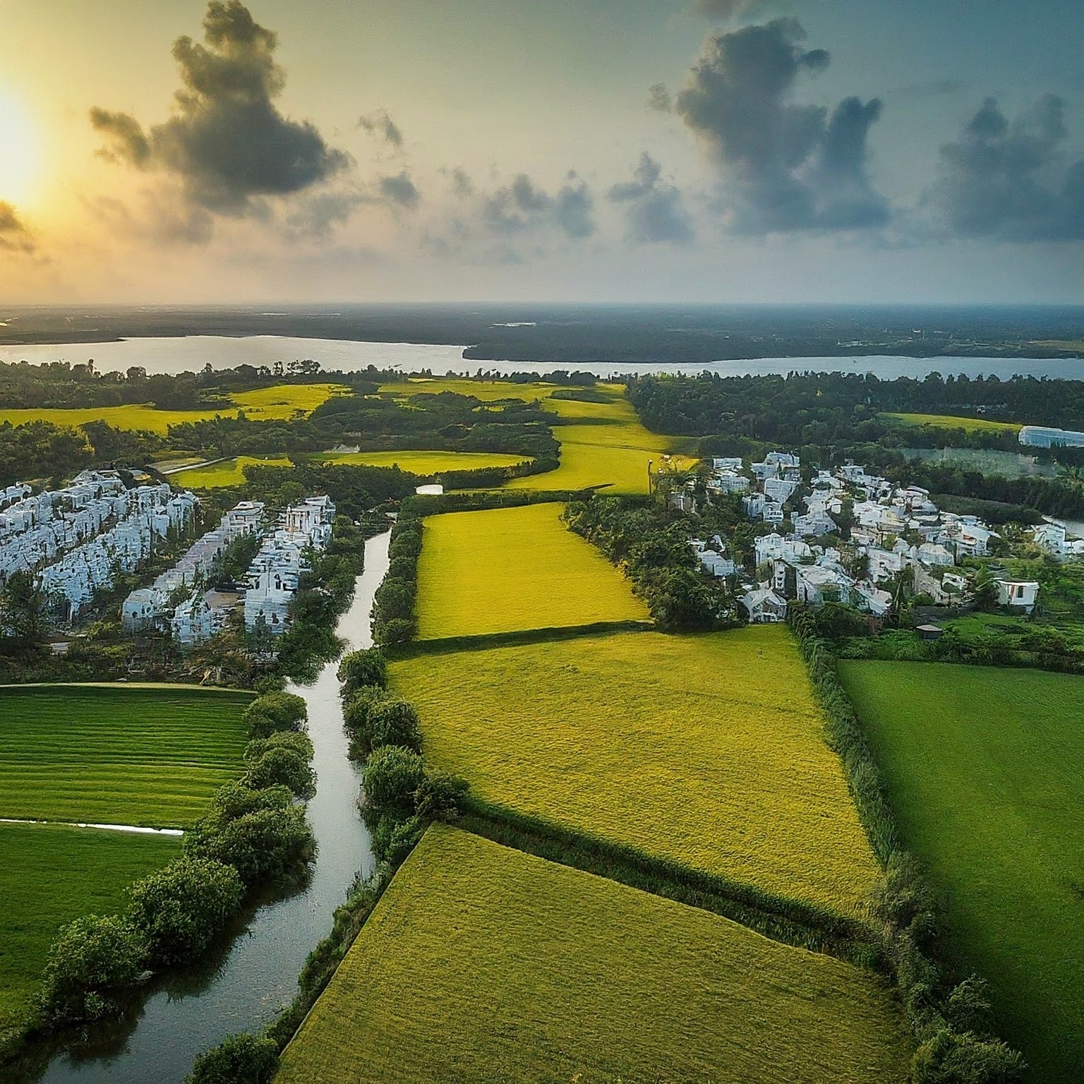
- ഡ്രോൺ സർവേ: കൃത്യമായ മാപ്പ് സൃഷ്ടിക്കാൻ ഡ്രോൺ ഉപയോഗിക്കുന്നു.
- ജിപിഎസ് സർവേ: ഭൂമിയുടെ സ്ഥാനം കൃത്യമായി രേഖപ്പെടുത്താൻ ജിപിഎസ് സാങ്കേതിക വിദ്യ ഉപയോഗിക്കുന്നു.
- ലേസർ സ്കാനിംഗ്: കെട്ടിടങ്ങളുടെ 3ഡി മാതൃകകൾ സൃഷ്ടിക്കാൻ ലേസർ സ്കാനിംഗ് നടത്തുന്നു.
3. ഡാറ്റാ സംയോജനം:
- ഡാറ്റാ ശേഖരണം: ശേഖരിച്ച ഡാറ്റാ സംയോജനം ചെയ്ത് കേന്ദ്ര ഡാറ്റാബേസിലേക്ക് അപ്ലോഡ് ചെയ്യുന്നു.
- ഡിജിറ്റൽ മാപ്പുകൾ: ശേഖരിച്ച ഡാറ്റ ഉപയോജിച്ച് ഡിജിറ്റൽ മാപ്പുകൾ സൃഷ്ടിക്കുന്നു.
4. വിലയിരുത്തൽ, അവലോകനം:
- പാരമ്പര്യ രേഖകളുടെ പരിശോധന: പഴയ രേഖകളും പുതിയ ഡാറ്റയും താരതമ്യം ചെയ്യുന്നു.
- അവലംബ നിഷ്പക്ഷത: ഡാറ്റയുടെ കൃത്യത ഉറപ്പാക്കാൻ അവലംബ പരിശോധന നടത്തുന്നു.
ഡിജിറ്റൽ സർവെയുടെ പ്രയോജനം
- ഭൂമിയുടെ കൃത്യമായ രേഖകൾ: കൃത്യമായ രേഖകൾ, ഭൂമി സംബന്ധിച്ച വസ്തുതകൾ പകർന്ന് നല്കും.
- നൂതന സാങ്കേതിക വിദ്യ: ഡ്രോൺ, ജിപിഎസ്, ലേസർ സ്കാനിംഗ് പോലുള്ള പുതിയ സാങ്കേതിക വിദ്യ ഉപയോഗിച്ച് കാര്യക്ഷമത വർദ്ധിപ്പിക്കുന്നു.
- വഴക്കങ്ങളും തർക്കങ്ങളും കുറവ്: ഭൂമി സംബന്ധിച്ച തർക്കങ്ങൾ, വൈകി നടക്കുന്ന വഴക്കങ്ങൾ എന്നിവ കുറയും.
- വിപണി സമ്പത്തും വളർച്ചയും: ഭൂമി ഇടപാടുകൾ സുതാര്യമായി നടപ്പാക്കുക വഴി വിപണി സമ്പത്ത് വർദ്ധിക്കുന്നു.
കേരളം, 2024-ൽ ഡിജിറ്റൽ സർവേ പ്രോജക്റ്റ് വഴി ഭൂമി രേഖകളിൽ ക്രാന്തിമാറുന്ന മാറ്റങ്ങൾ വരുത്തുന്നു. സാങ്കേതിക വിദ്യയുടെ പ്രയോജനം ഉപയോഗിച്ച് ഭൂമിയുടെ പാരദർശിത്വവും കൃത്യതയും ഉറപ്പാക്കുകയാണ് കേരളത്തിന്റെ ലക്ഷ്യം. ഈ ഡിജിറ്റൽ മാറ്റങ്ങൾ, സംസ്ഥാനത്തെ വാണിജ്യ, വ്യവസായ മേഖലകളിൽ വലിയ വളർച്ചയും സുതാര്യതയും കൊണ്ടുവരുന്നതാണ്.
Digital Survey Kerala: Transforming Land Records in 2024
Kerala is renowned for its technological advancements, and the state continues to integrate digital methods across various sectors. The government is keen on implementing digital changes in administrative functions to enhance efficiency and transparency. One significant initiative in this direction is the Digital Survey. In 2024, Kerala is set to embark on a comprehensive digital survey project to modernize land records. This blog explores the benefits, stages, and impact of the Digital Survey in Kerala.
What is the Importance of a Digital Survey?
The Digital Survey project aims to provide precise and transparent details of land and its usage using advanced technology. Here are some key benefits:
- Transparency: Ensures detailed and accessible land records for the public.
- Accountability: Reduces land disputes and ensures ownership clarity.
- Economic Benefits: Minimizes delays in survey processes, enhancing efficiency in land transactions.
Digital Survey 2024: Project Stages
1. Preliminary Preparation:
- Project Planning: The state government, in collaboration with relevant institutions, drafts the project outline.
- Technical Training: Employees are trained in the required technical skills.
- Procurement of Equipment: Acquiring necessary survey equipment such as drones, GPS devices, and laser scanners.
2. Survey Process:
- Drone Survey: Drones are used to create accurate maps.
- GPS Survey: GPS technology records precise land positions.
- Laser Scanning: Laser scanning generates 3D models of buildings.
3. Data Integration:
- Data Collection: The collected data is integrated and uploaded to a central database.
- Digital Mapping: Creating digital maps using the integrated data.
4. Evaluation and Review:
- Verification of Legacy Records: Comparing old records with the new data.
- Accuracy Check: Ensuring the accuracy of the data through reference checks.
Benefits of the Digital Survey
- Accurate Land Records: Provides detailed and precise land information.
- Advanced Technology: Utilizes modern technologies like drones, GPS, and laser scanning for improved efficiency.
- Reduced Disputes: Minimizes land-related disputes and delays in resolving issues.
- Market Growth: Enhances transparency in land transactions, fostering economic growth and market stability.
Kerala’s Digital Survey project in 2024 marks a revolutionary change in land record management. By leveraging technology, the state aims to ensure transparency and accuracy in land information. This digital transformation promises to bring significant benefits to the commercial and industrial sectors, driving economic growth and fostering a more transparent and efficient land management system in Kerala.